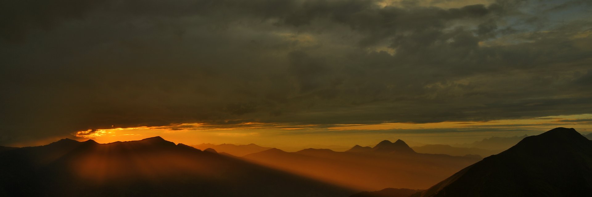
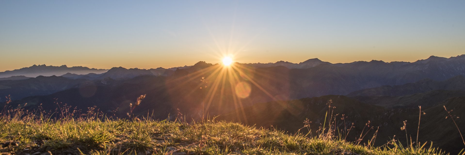
The magnificent panorama, dreamlike sunsets and sunrises are well worth the climb.
Below you will find an explanation in more detail.
Getting there: Highway A10, exit Bischofshofen, St. Johann im Pongau from Grossarl to Hüttschlag or via St. Johann im Pongau Schwarzach and the Gastein Valley. From the South (e.g. Carinthia) to the Gastein Valley you can use the Tauernschleuse ÖBB from Mallnitz to Bockstein.
Maps and tour guides:
These maps and guides can be purchased from me (price plus postage)! Simply send me an email with your postal address. After I receive your bank-transfer I will send the chosen products to you.
Access paths to the Gamskarkogel hut:
Use good shoes and be careful. Although the footpaths are usually in good condition, you are walking on steep parts where it could be dangerous, especially in wet conditions. If you are not sure about the conditions, just call the innkeeper. Alpin Salzburg can provide you with some important information about dangers in the mountains. This is a service of Lawinenwarnzentrale Salzburg (avalanche-warning-center) in collaboration with the mountain rescue and others. The Club of the Salzburg hike guides is another partner.
Tour 1: with the taxi from Bad Hofgastein to Rastötzenalm - Gamskarkogel,
The altitude is approximately 700 meters and the walking time is about 1,5 hours. Taxi (Taxi Rudigier +43 (0) 6432 6611 or 6622) from Bad Hofgastein to Rastötzenalm (1.743m).
From Rastötzenalm (a very nice place where a visit is recommended, with a total of three alpine huts) you walk on the path 513 (502A) around the Rauchkogel and on a nice path to the summit of Gamskarkogel with the Gamskarkogelhütte (2,467 m). Another alternative is the path 513A that runs a little bit more to the east. Can be used for ascent and descent or as the ascent on Tour 4, back to the starting point with taxi or public transport.
Tour 2: Bad Hofgastein (Annencafé) - Rastötzenalm - Gamskarkogel
The altitude is approximately 1,400 meters and the walking time is about 4 hours.
Note: The parking lots that are close to the Annencafé are only for guests of this café and only during their stay at the café! The parking lots are marked accordingly.
Use the waterfall path (513, 502A) to get to the Rastötzenalm. After that you use the same ascent path as in Tour 1 and for descent also as in Tour 1.
Tour 3: Bad Hofgastein - Rastötzenalm - Schmalzscharte - Frauenkogel - Gamskarkogel
The altitude is approximately 1,500 meters and the walking time is about 5,5 hours.
At Rastötzenalm take route 513B north to the Schmalzscharte (2.159m), turn right and continue on 513B via the Tennkogel (2.333m) and Frauenkogel (2.424m), first slightly downhill to the summit of Gamskarkogel with the Gamskarkogelhütte (2,467 m). Descent via the path 513 (502A) to Rastötzenalm.
Tour 4: Bad Gastein - Poserhöhe - Gamskarkogel
The altitude is approximately 1,350 meters and the walking time is about 4 hours.
The Parking is marked "... dedicated to the walkers by Bad Gastein ..." About 200 in front of you will reach The Hoteldorf Grüner Baum. Turn left, walk through the areal of the hotel and you will start your hike about 1.5 hours to Poserhöhe on 1.505m via a steep path. Via the Tofernscharte (2.090m) you will reach the summit of the Gamskarkogel with the Gamskarkogelhütte (2.467m). You can also descent as well as ascent via the Rastötzenalm to Bad Hofgastein back to the starting point by taxi or public transport.
Tour 5: (Großarlvalley) Per hiking taxi to Harbachalm - Gamskarkogel
The altitude is approximately 850 meters and the walking time is about 2.5 hours.
Take hiking taxi (Taxi Aigner +43 6414 361; Taxi Raab +43 6414 8221; Taxi 600 +43 6414 600) from Großarl or Hüttschlag to Harbachalm (1.612m).
Descent as ascent, or change into the Gastein Valley. The return to the starting point by public transport is however a little bit more time consuming ...).Tour 6: Hüttschlag - Harbachalm - Gamskarkogel
The altitude is approximately 1,250 meters and the walking time is about 4 hours.
From here you walk to Harbachalm (1.612m), to here you can also take the taxi (as Tour 5). Towards 514 (502A) to Tofernalm (1.820m) and the Tofernscharte (2.090m), turn right to go to the summit of Gamskarkogel with the Gamskarkogelhütte (2.467m). Descent as ascent or change into the Gastein Valley. The return to the starting point by public transport is however a little bit more time consuming ...
Tour 7: Ski-Tour Hüttschlag - Gamskarkogel
The altitude is approximately 1,250 meters and the walking time is about 4 hours.
When the snow- and weather conditions are good, the Gamskarkogel is a great ski-tour mountain with magnificent and spacious slopes in the south-east and east directions. In the upper part there is enough room for you to make you orwn downhill lines. The trip can start as described in Tour 6. Through the Harbachalm, the Tofernalm (1,820m) and the Tofernscharte (2,091m). Turn right here in the direction of Gamskarkogel and walk up to the summit of the Gamskarkogel. It is also possible to walk directly to the summit via the Tofernalm. For the decent you walk the same way.
At the moment there is no service at the Gamskartkogelhütte during the winter.
A Request:
Gamskarkogel
Alpine Hut at 2.467m a.s.l.
5630 Bad Hofgastein
mobile: +43 676 45 19 850 www.gamskarkogelhuette.at